Millions of Americans along the U.S. Pacific Coast may be living under an invisible, growing threat: a catastrophic mega tsunami triggered by a major Cascadia Subduction Zone earthquake. A new, high-impact study from Virginia Tech, led by geoscientist Dr. Tina Dura, has issued a stark warning, predicting a 15% chance of a magnitude 8.0+ earthquake in the region within the next 50 years—an event that could unleash a wall of water over 1,000 feet high and devastate coastal cities in minutes.
This is not speculative science fiction—this is a data-backed projection based on updated geological evidence and modeling that shows the Pacific Northwest could be the epicenter of one of the most destructive natural disasters in recorded history.
🌍 Why the Cascadia Subduction Zone Is a Time Bomb
The Cascadia Subduction Zone (CSZ) is a 600-mile fault line running from Northern California through Oregon and Washington to Vancouver Island. It’s one of the few places on Earth where two tectonic plates are locked—creating massive seismic pressure.
The Juan de Fuca Plate, a small oceanic plate, is steadily being forced beneath the larger North American Plate, creating a ticking geological time bomb. Unlike California’s more famous San Andreas Fault, Cascadia is quieter—but far more dangerous. It hasn’t ruptured since 1700, when a magnitude 9.0 quake and tsunami devastated coastal Native American villages and reached as far as Japan.
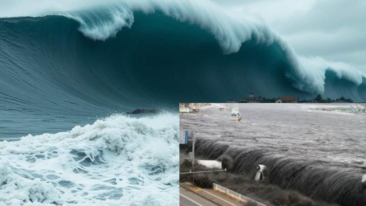
🚨 The Threat: 1,000-Foot Waves and Minutes to React
Virginia Tech’s updated simulations suggest that when (not if) the next major Cascadia quake strikes, the coast could drop by several feet within seconds, shifting the shoreline inland and allowing a tsunami to surge across land at jet-speed.
Key projections include:
- Wave heights of up to 1,000 feet in localized areas.
- Seattle, Portland, Eugene, Coos Bay, and Eureka among high-risk urban zones.
- Evacuation time in many regions could be under 10 minutes.
“This isn’t about scaring people. It’s about preparing for a likely event that could change the Pacific Northwest forever,” said Dr. Tina Dura.
📍 Southern Washington & Northern Oregon: Ground Zero
Communities near the coastlines of Grays Harbor, Astoria, Tillamook, and Newport sit directly above or beside the CSZ and face the highest risk. Land subsidence in these areas could be up to 6 feet, turning roads and emergency infrastructure into flood zones instantly.
Many towns lack vertical evacuation routes or elevated safe zones, prompting experts to call for urgent action—including the construction of tsunami towers and early-warning systems.
🛠️ What Experts Say Must Happen Now
Experts are urging federal and state governments to:
- Invest in community-scale evacuation infrastructure.
- Fund public awareness campaigns and school preparedness programs.
- Strengthen building codes in vulnerable cities.
- Deploy advanced offshore sensors and deep ocean buoys to enhance early warning systems.
Without preparation, they warn, a Cascadia megaquake could result in tens of thousands of deaths and hundreds of billions in damages.
🔮 The Outlook: A Generation at a Crossroads
Sea level rise due to climate change only compounds the risk. As the ocean encroaches on Pacific shorelines, the margin for error shrinks. Entire communities may have to relocate inland in the coming decades if long-term adaptation plans aren’t enacted.
“This is not a distant threat,” Dr. Dura emphasized. “This is a very real possibility in our lifetimes.”
⚠️ Final Word
The Virginia Tech report is a sobering call to action—not just for the Pacific Northwest, but for the nation. As science sharpens its warnings, the question now becomes: Will we act in time?